Where Generations Unite
Kleinpaschleben, Germany · 2024
Kleinpaschleben had an elementary school. The school closed. What it left behind was a sports hall that still worked, a school building that no longer did, and 16,000 square metres of ground between them with nothing asked of it.
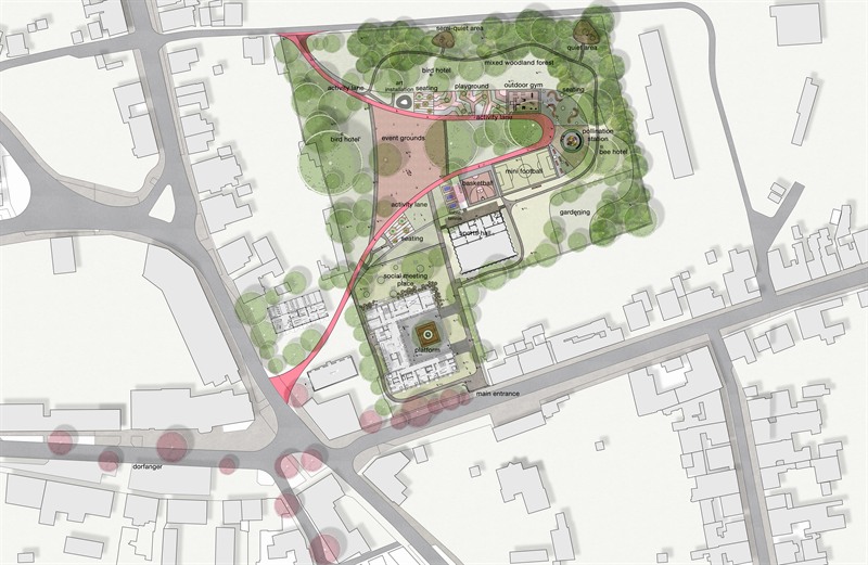
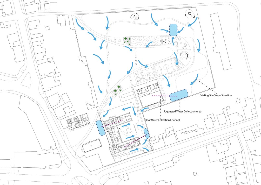
The site is a wedge held inside the village: roads along the south and east, houses backing onto the north and west, and the Dorfanger, the old village green, just beyond the south-west corner. The ground was already at the centre of things. It had simply stopped being for anybody.
The brief was to turn that ground into a community centre, under the motto Healthy Together Living. The harder question was what would bring anyone to it, because a community centre in a village this size cannot advertise. It gets its visitors from people who were walking past anyway and decided to come in.
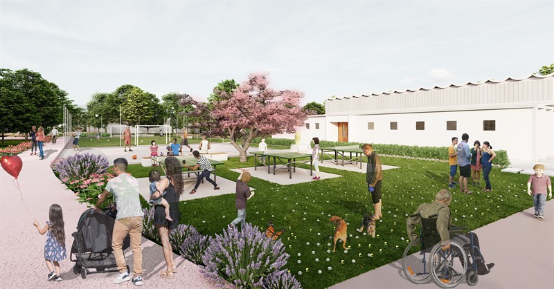
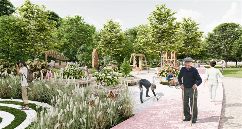
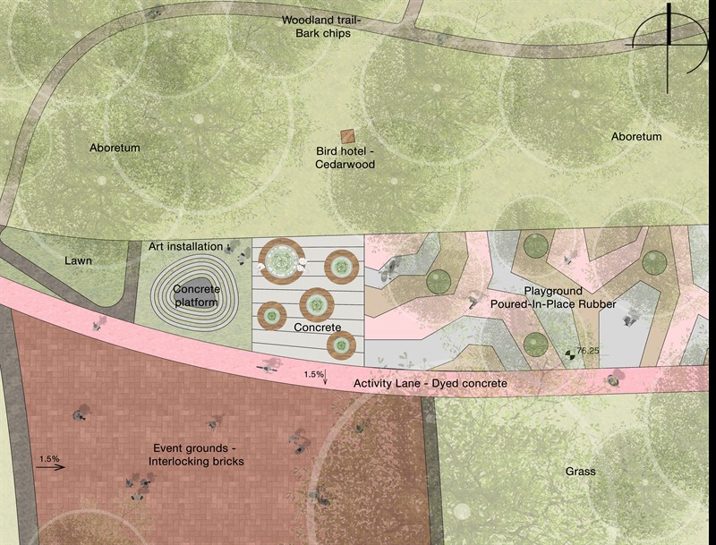
One route does most of the work. The activity lane starts at the main entrance, runs past the sports hall and the courts, opens out at the event grounds and the social meeting place, and ends in woodland. Most of what happens on the site happens on the lane or just off it, so nobody has to understand the plan to find their way around.
The scheme has two authors. We drew it with David Baah Oduro, from the site analysis through to the last sheet, and every surface on it was settled between us.
- Location
- Kleinpaschleben, Germany
- Context
- Master’s semester project, Hochschule Anhalt
- Disciplines
- Landscape
- Role
- Co-author, whole scheme
- With
- David Baah Oduro, landscape architect
- Site area
- 16,000 m²
- Status
- Design complete
What to notice
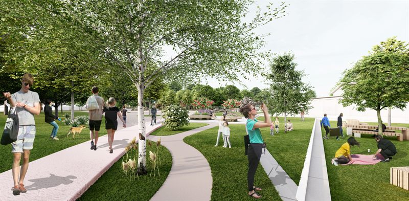
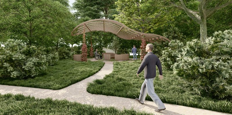
The trees thin as you go in. Around the edge they are planted densely, a belt that closes the ground off from the roads on two sides and the houses backing onto the other two. Toward the middle they thin out, until the event grounds and the social meeting place sit in the open with only scattered canopy over them.
That is a sightline, not a picture. A space meant for everybody has to be one you can see across: a parent needs to watch a child from a bench, and somebody arriving on their own needs to see who is already there before deciding to walk in. The belt does the screening at the boundary so that the middle does not have to.
 Full size
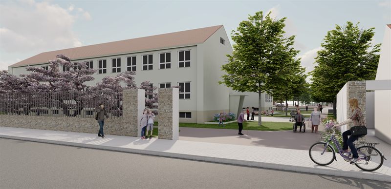
Left to right: the entrance and its pink cherry · the platform · the social meeting space · seating · the event grounds · the activity lane

Swipe sideways to see the whole section.
Where this stops being true
None of this is built, and the part that matters most is not landscape at all. The scheme is designed to bring people to a community centre inside a school building that has yet to be given its new use. If that use does not arrive, the ground is a good park beside a closed school, and these drawings describe a route to somewhere nobody is going.
Accessibility is a condition rather than a construction. The lane has no steps for as long as somebody keeps it that way. Ground freezes here, and a surface that settles or lifts by twenty millimetres has a step in it for anyone on wheels. In winter, whoever owns the ground has to clear and grit a strip of roughly 1.20 metres by seven in the morning, so for those months the route in these drawings is as wide as somebody with a shovel decided to make it.
And the school closed for a reason. A village loses its elementary school when there are not enough children to fill it, and this scheme puts a playground, an outdoor gym and a mini football pitch on the school’s old grounds. It is drawn for the generations still here and for the ones that might come back. Only one of those is a fact.